
The State Highway and its Roadside Architecture
California’s road system began with Native American routes, later evolving into emigrant trails, stagecoach routes, earthen roads, and paved highways and freeways. The advent of automobile travel inspired a unique architectural vocabulary. Roadside architecture and creative signage design were intent on capturing attention and being highly visible and memorable. In some instances, design embodied the notion of speed. Remnants of this architectural legacy can be found throughout the state and here in Orange County as well.
Beginning in 1880 the Good Roads Movement advocated for paved roads for the then-modern mode of cycling. Throughout the nation progress began, gaining major momentum that was further enhanced by the advent of the automobile and the establishment of the Automobile Club of California in 1901. Nine years later saw passage of the first State Highways Act, along with $18 million in bond financing. With this funding construction began on the State Highway, a designation of existing roads that over time were connected, augmented, and realigned. The route was designated Highway 101 by the legislature in 1925 and variously known as the State Highway and the Old State Highway.
The El Camino Real
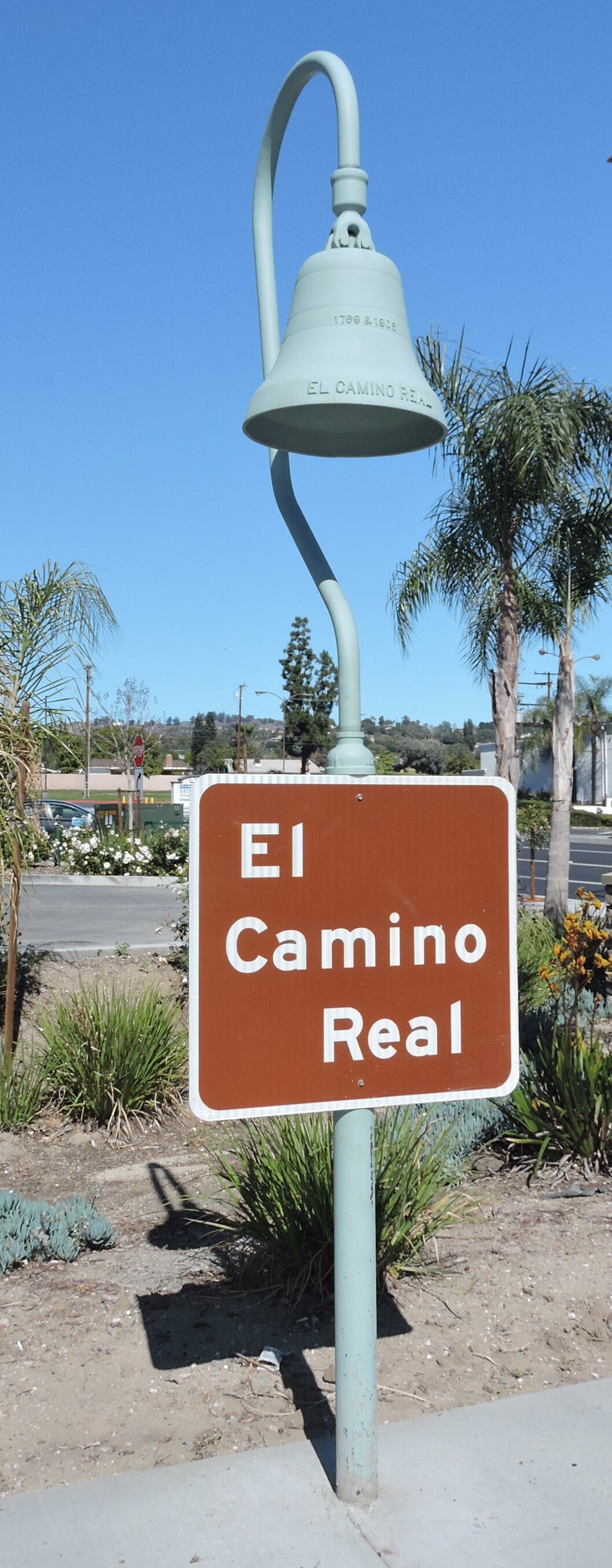
The state’s authorization referred to the route as El Camino Real, conceived at the time as 600-some miles of trails linking the chain of missions and presidios built throughout the state between 1769 and 1833. The notion that there was only one route, imbued with romantic illusions of the Mission era, was promoted by the California Federation of Women’s Clubs and Auto Club among others, and kicked into high gear with the establishment in 1904 of the El Camino Real Association. By 1914, the group had installed more than 400 roadside markers with a cast metal bell suspended from a shepherd’s hook. As time went on, a number of markers were damaged or stolen. From 1926 to 1931 the Automobile Club assumed responsibility for maintenance of the bells on state property. Caltrans took over the program in 1975 with replica bell markers bearing the dates 1769 and 1906 to commemorate the founding of the first mission and the installation of the first marker by the Association.
From La Habra to Tustin: Motels and Signage
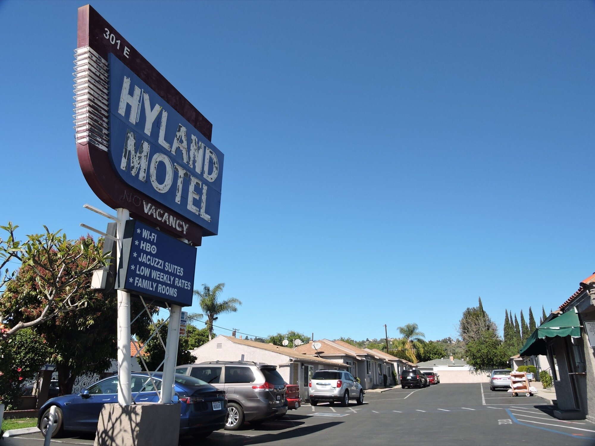
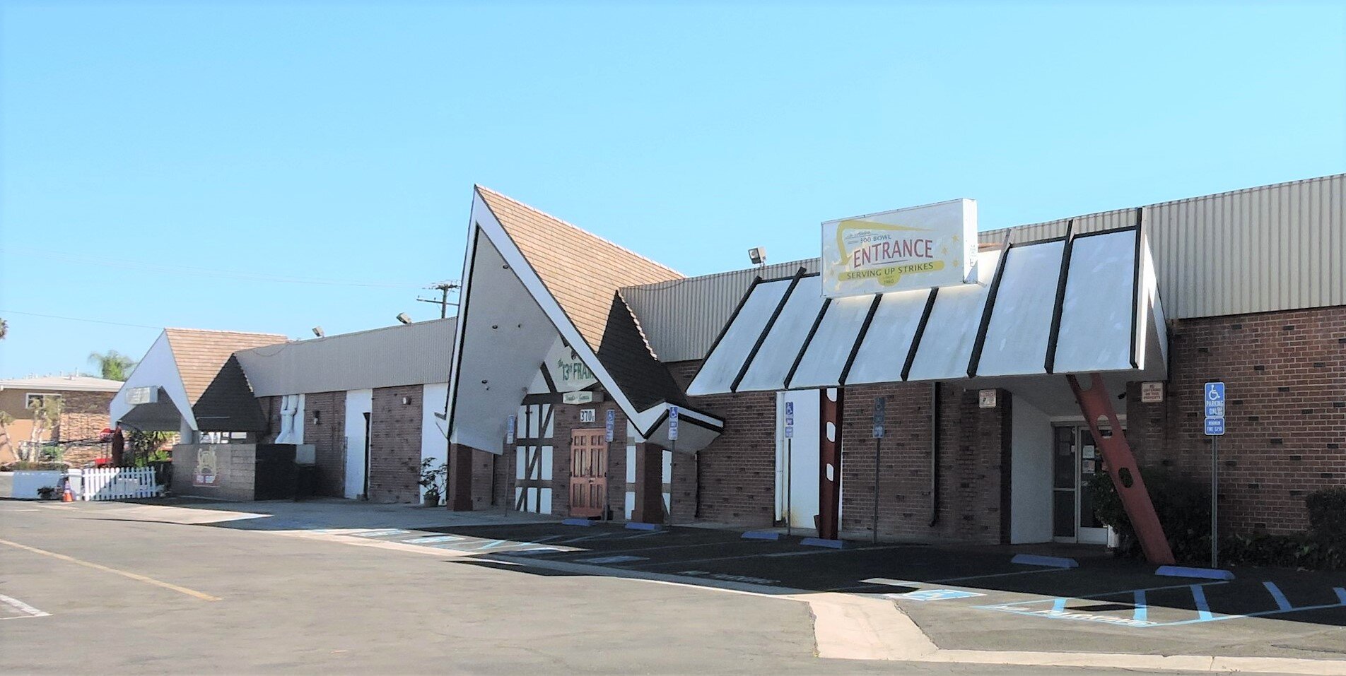
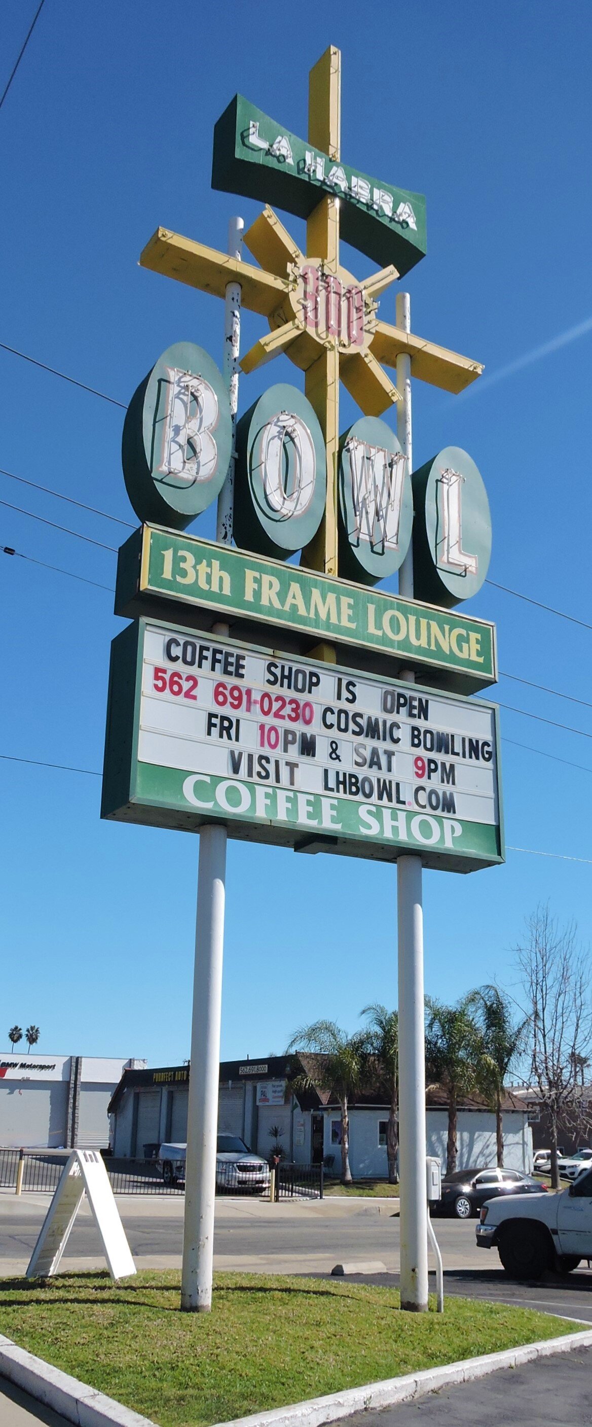
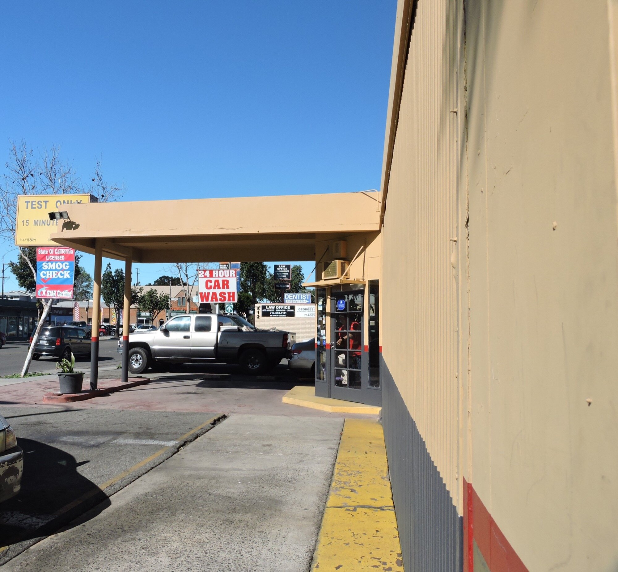
Surviving roadside architecture along the route still tells the story of the importance of the roadway in the 20th century. Often the signage for these establishments has survived best, particularly metal signs with or without neon. The late historian Phil Brigandi has a useful article on tracing the route of the early State Highway on today’s Orange County roads and freeways. The State Highway entered Orange County along Whittier Boulevard in La Habra. The Hyland Motel, while heavily altered, still sports its vintage metal and neon sign. The La Habra Bowl nearby boasts Googie architecture and a large vintage sign in a starburst design clearly visible to the traveling public. Further east is the first of the El Camino Real markers at Whittier Boulevard and Hacienda Road and another at Whittier and Euclid Avenue.
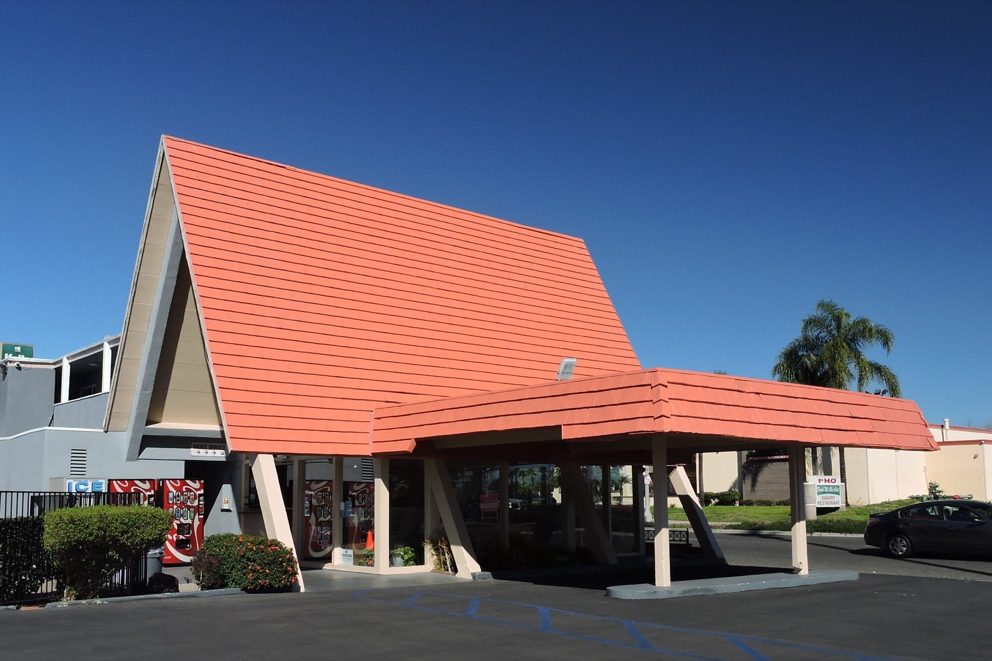
At Harbor Boulevard the route heads southward. Three El Camino Real markers grace the intersection of Harbor and La Habra Boulevards and in downtown Fullerton another stands in the center median between Amerige and Wilshire. Further south on Harbor Boulevard at Ash Avenue sits one of Orange County’s few remaining early gas stations. Willow Tree Lodge at Harbor Boulevard and Hill Avenue sports a dramatic A-line roof.
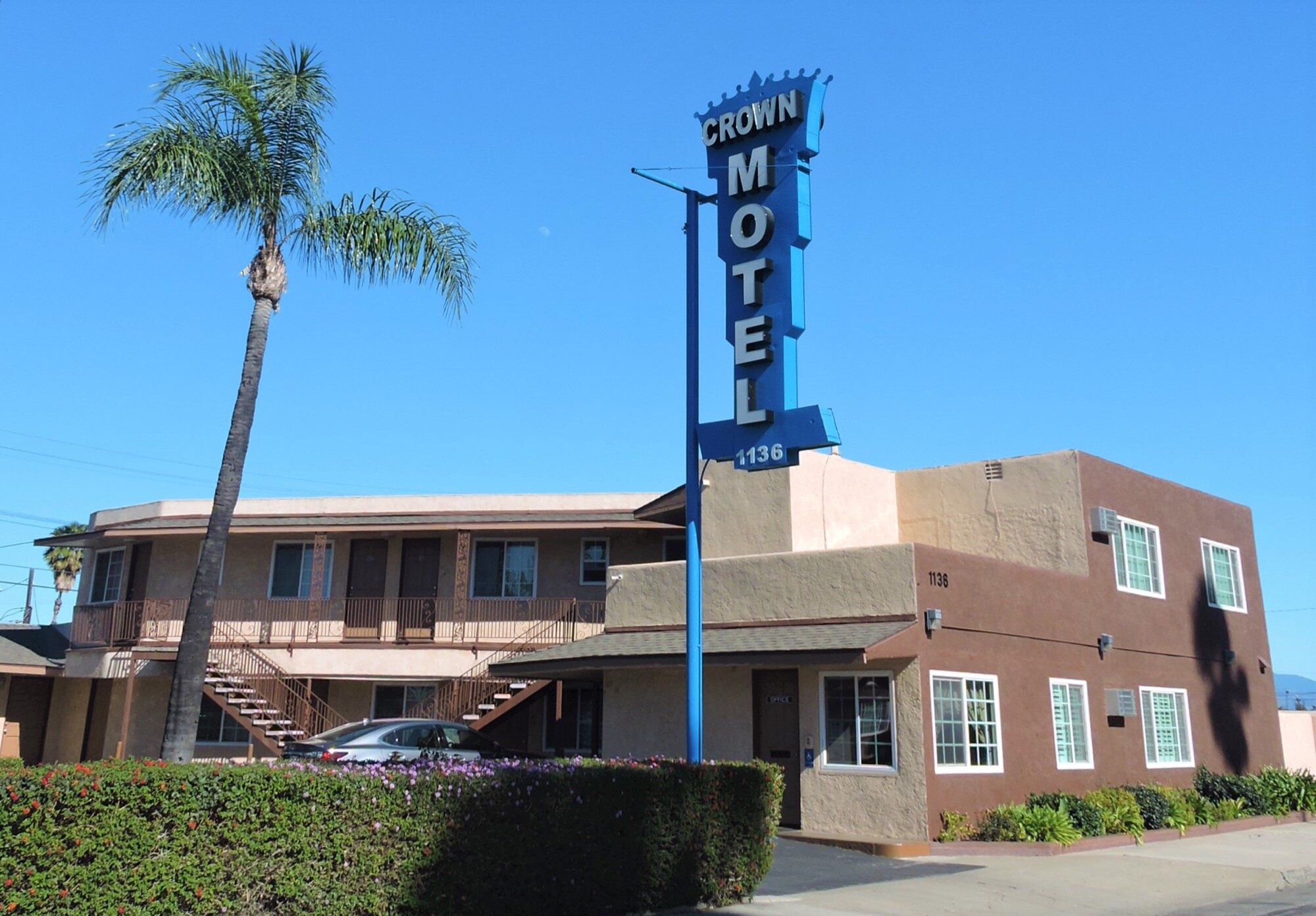
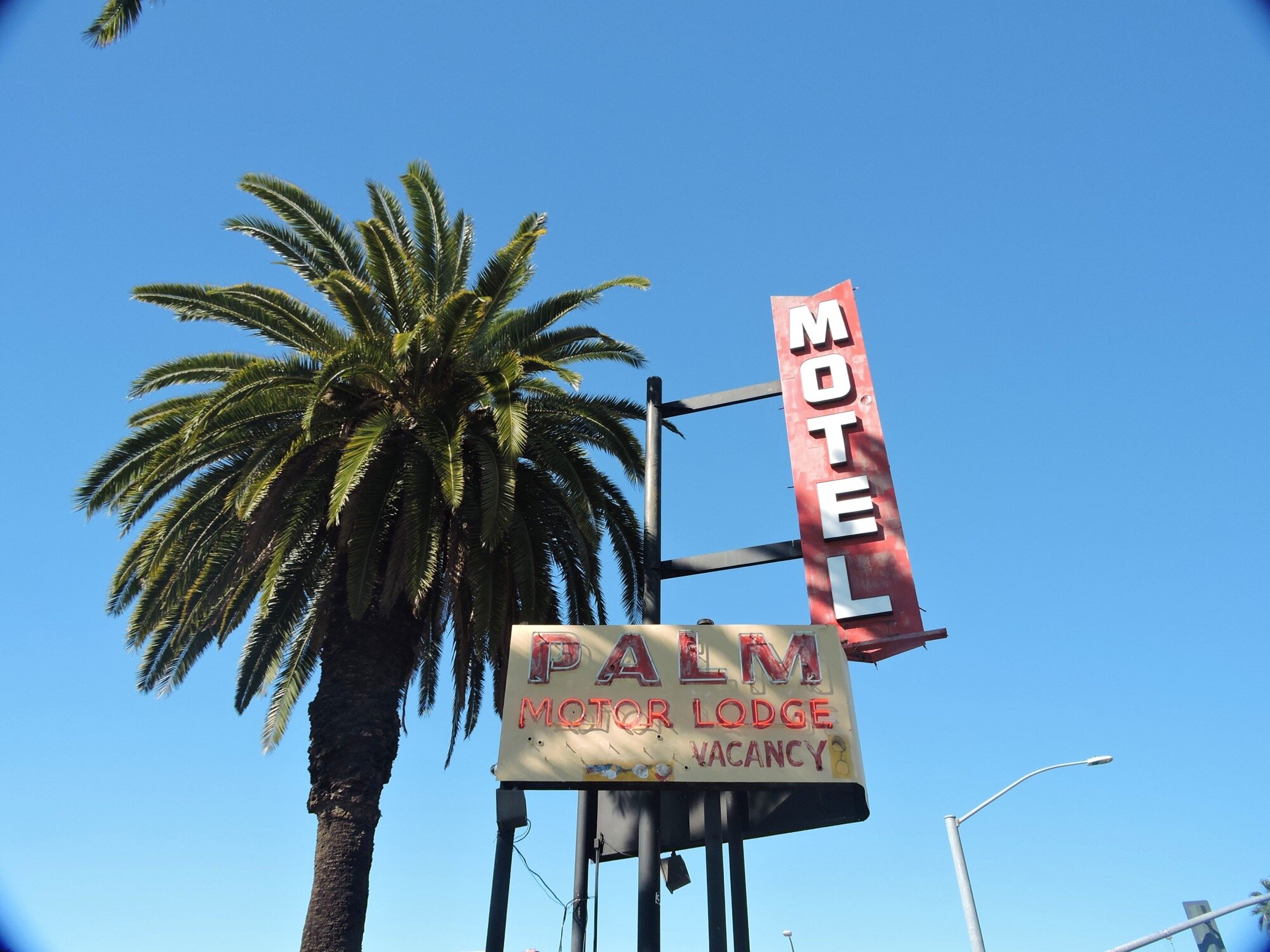
South of downtown Anaheim the Palm Motor Lodge has been heavily altered but its tall metal and neon sign is another example of vertically oriented signs meant to be easily visible to passing automobile traffic. At La Palma Park Way the route veers southeast and it’s here the Crown Motel attracts the eye of drivers with another vertical metal sign in the shape of a crown. South of La Palma Boulevard the route can be roughly traced south along Anaheim Boulevard then southwest along Manchester, paralleling Interstate 5, to head east on Chapman Avenue.
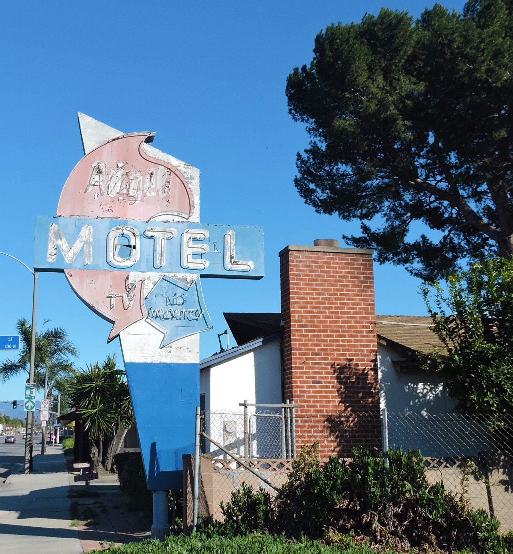
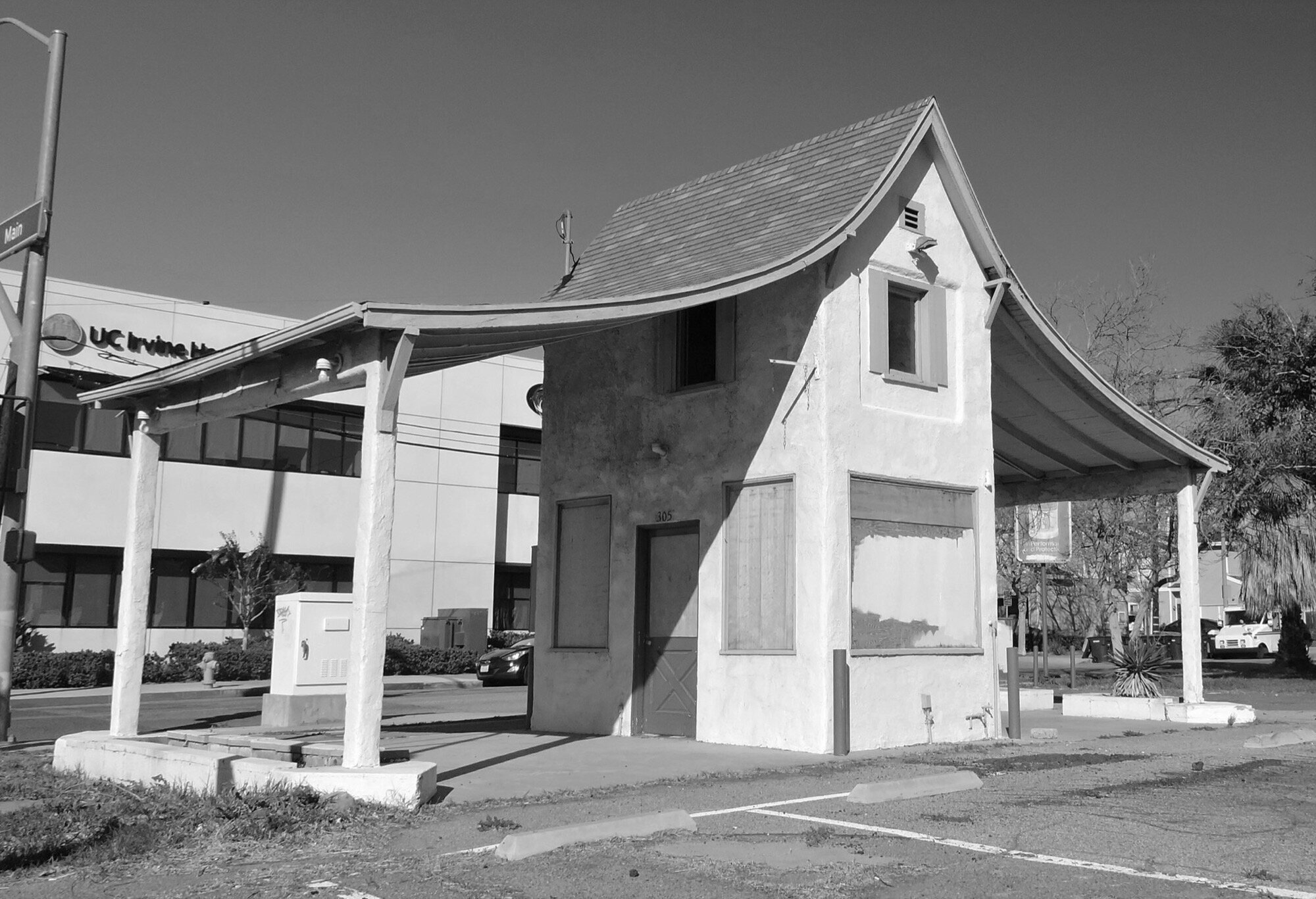
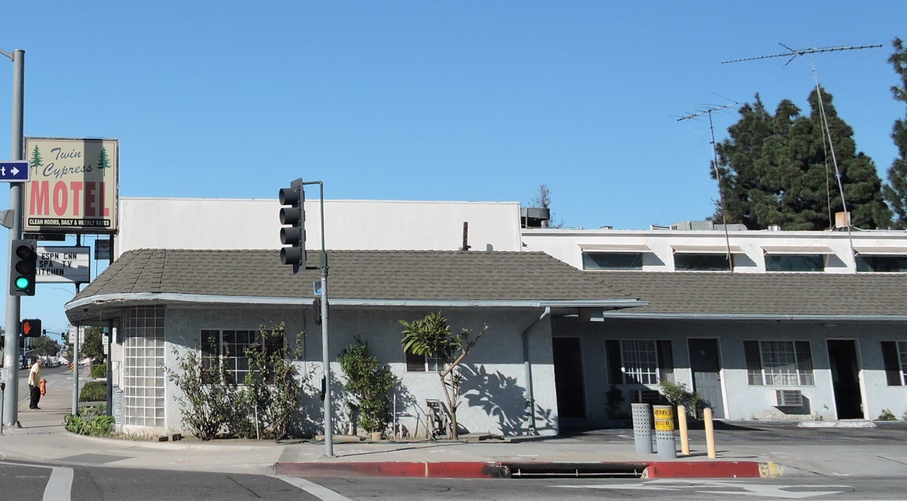
Soon after passing into Orange, the Angel Motel is another small establishment with stylized signage. At Main Street in Orange the route heads south, passing the circa 1928 Christiensen and Grow filling station with its storybook architecture and the Twin Cypress Motel. This area was originally known as Orana, that is, between Orange and Santa Ana, with businesses serving the passing traffic.
Southward is Santa Ana, and while many historic buildings remain, they were developed primarily toward serving local businesses, homes, and institutions characteristic of period urban cores. Likewise, this pattern continues through Tustin where a portion of the roadway still retains the name El Camino Real. Between First and Sixth Streets a number of El Camino Real marker bells remain. Interstate 5 replaced the State Highway south of here through what was then agricultural fields and pastureland.
From Mission to Googie
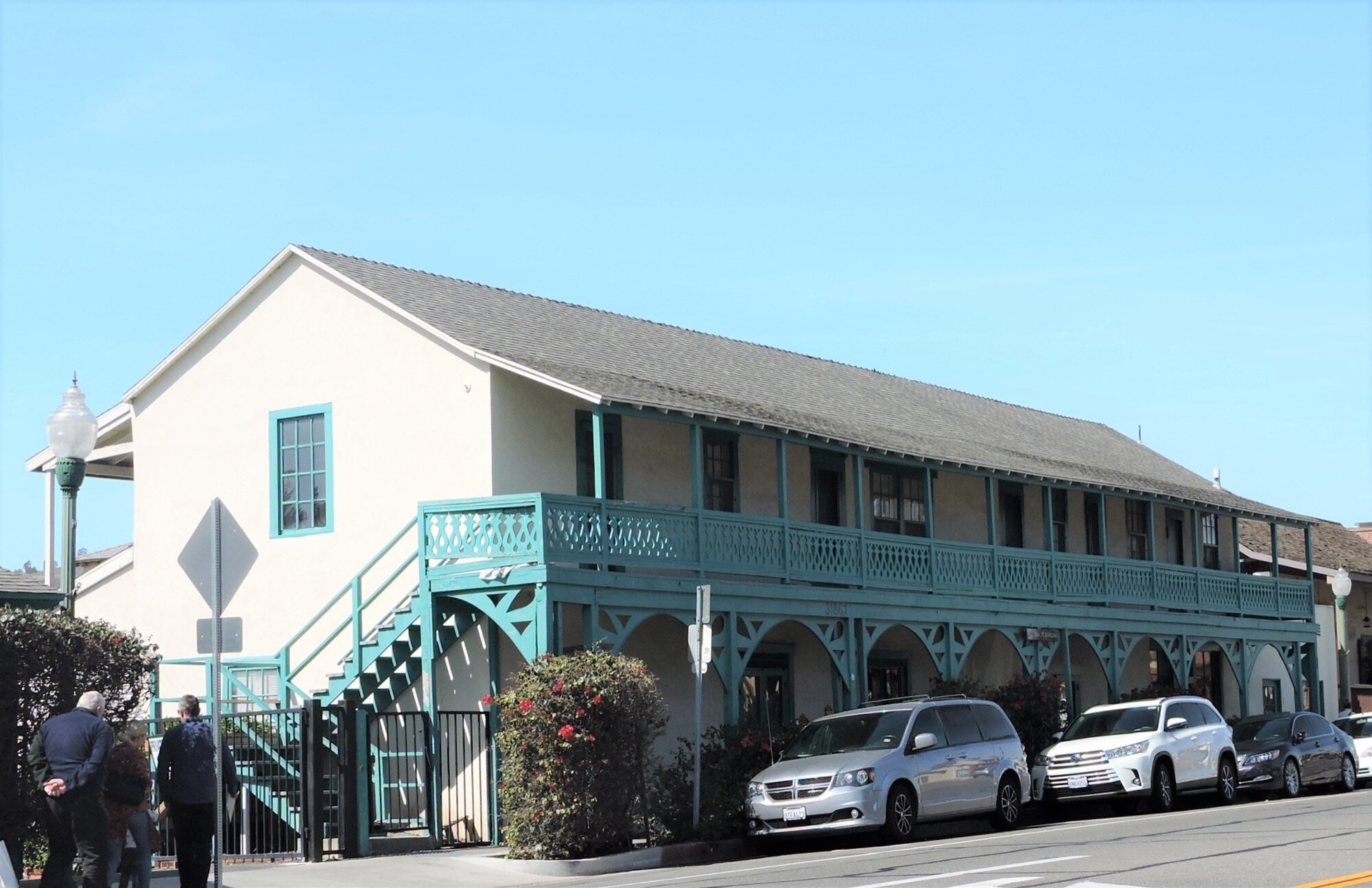
Design for roadside architecture deviates from the typical pattern as the route diverges from Interstate 5 at Camino Capistrano. Mission San Juan Capistrano was one of the destinations along the original route. The Mission and the surrounding commercial core and residential neighborhoods are among the oldest in Orange County. Casa Manuel Garcia sits one block south of the Mission, originally built as a one-story commercial building to which a second floor hotel was added in 1840. It carries a number of distinctions: the first hotel and the only surviving two-story adobe, as well as a rare surviving Monterey style building in the county.
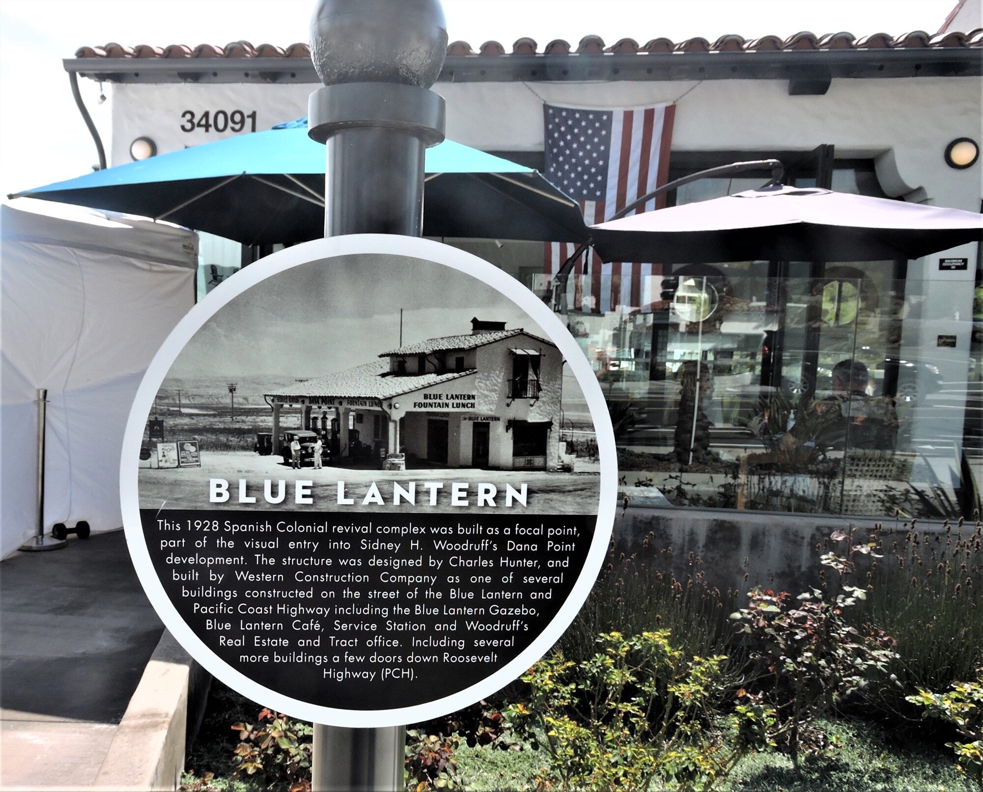
Since the earliest development of both Dana Point and San Clemente, the Spanish Colonial Revival style was a deliberate design decision. Along the former State Highway in Dana Point is the Blue Lantern Fountain Lunch and Service Station. When Anna Walker, the city’s first developer, built it in 1925 it was the first gas station south of Laguna Beach along the then-unpaved route. In 1928 it was sold and became part of what is known as the Woodruff Development that includes the 1929 Pacific Cleaners building with double arcade down the block that served as a gas station as well during part of its history. The Dana Villa Inn at Pacific Coast Highway and Dana Point Harbor Drive built in 1930 has since been demolished but is noteworthy for this description in the City’s Historic Resources Survey:
Early ‘tourist camps’ were tents rented out to tourists. Pasadena architect Arthur Heineman is credited with developing the concept of the motel in Pasadena. He adapted the bungalow court form to create motels from Pasadena to San Luis Obispo. The Dana Villa Inn designed by Woodruff architect Charles A. Hunter was the first on the South Coast. Each lodging space was built as an independent unit” on the second story, each with its own garage space on the first story.
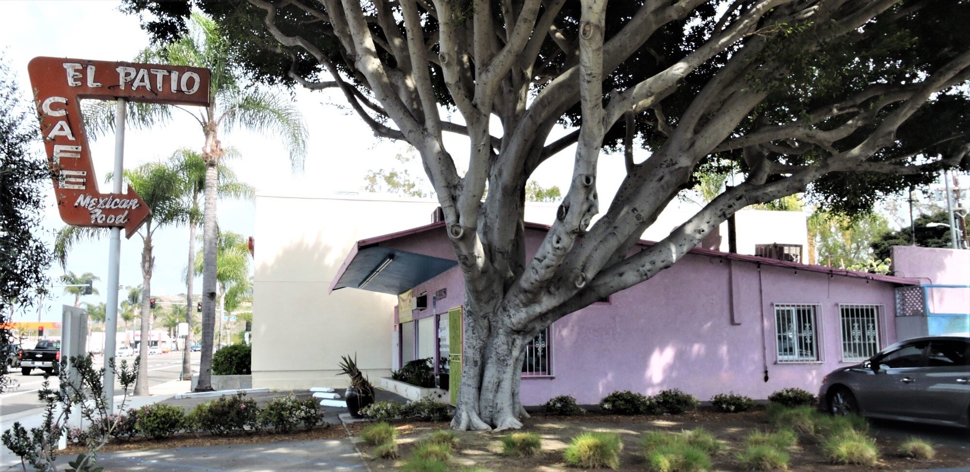
A classic metal and neon sign advertises El Patio Café in front of a simple mid-century building. Doheny State Beach is located at the southern end of Dana Point. Shortly after the Doheny family granted the land for the public beachfront, the Swallows Motel was built across the road. The two story board-and-batten office sits alongside a low stone building of motel rooms and is currently closed and fenced off.
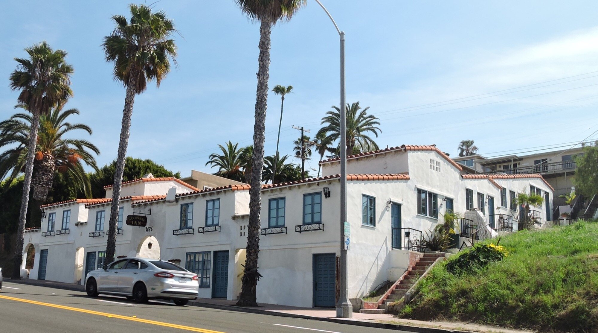
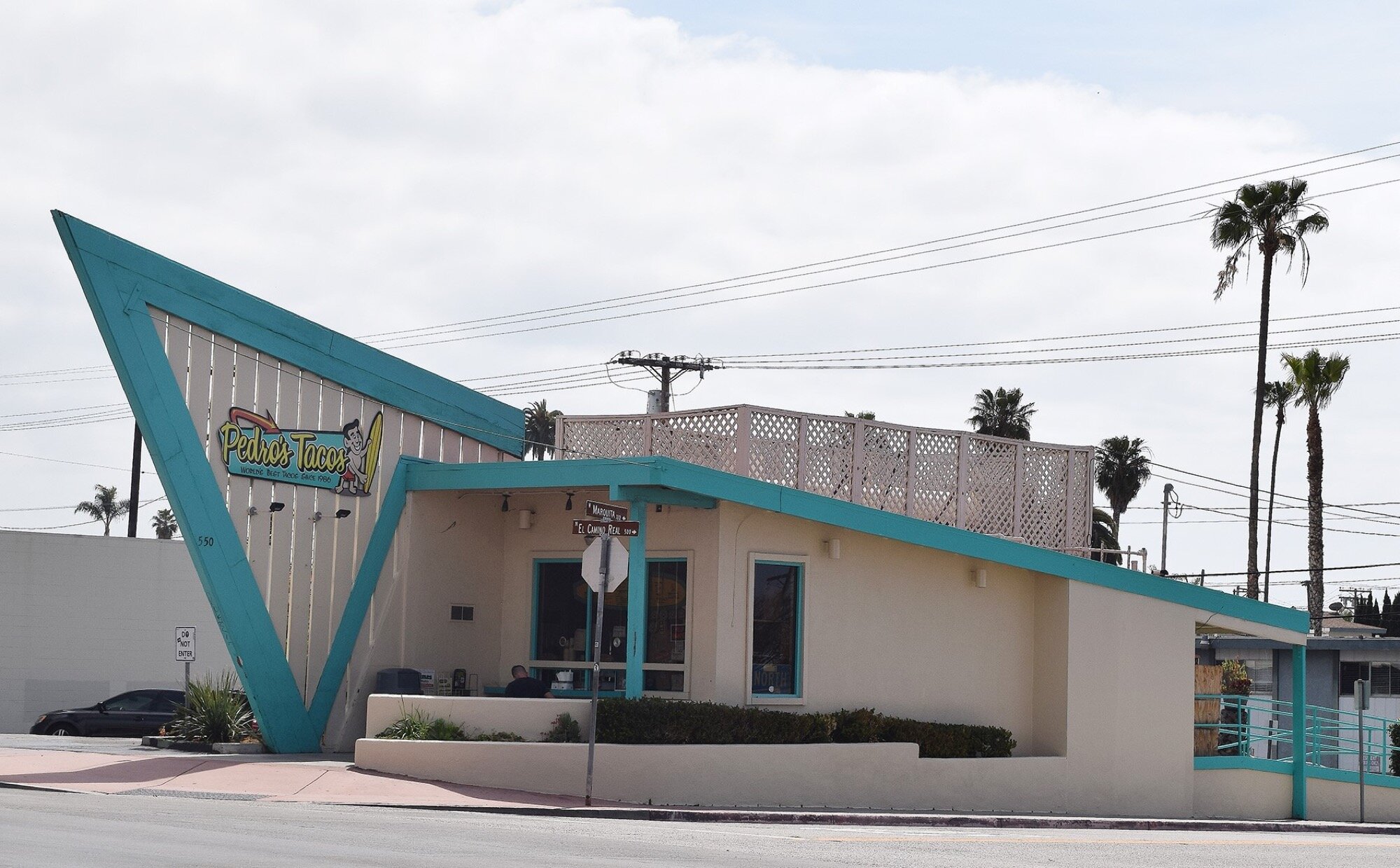
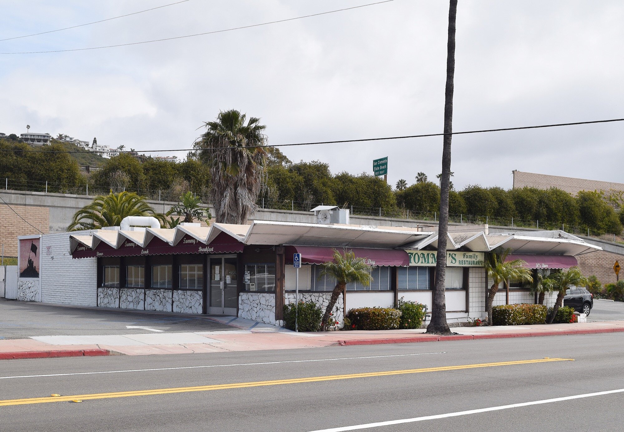
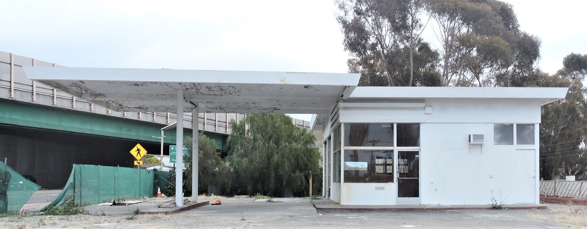
El Camino Real functioned as the main north-south thoroughfare through San Clemente until 1960 when Interstate 5 was constructed nearby. The commercial center of town flaunts a number of El Camino Real bell markers as well as custom designed streetlights that mimic the markers. Further south is the San Onofre Inn, originally built as a motel it now functions as rental apartments. Pedro’s Tacos dating from 1953 and designed by architect Hugh Kaptur is another simple architectural form but its angular blade projecting from the front façade grabs the attention of passing motorists. Another 1950s era diner on El Camino Real and Gaviota features zigzag roof elements. A final vintage metal gas station sits on the route at Valencia. It, too, is currently fenced off and its future unknown.

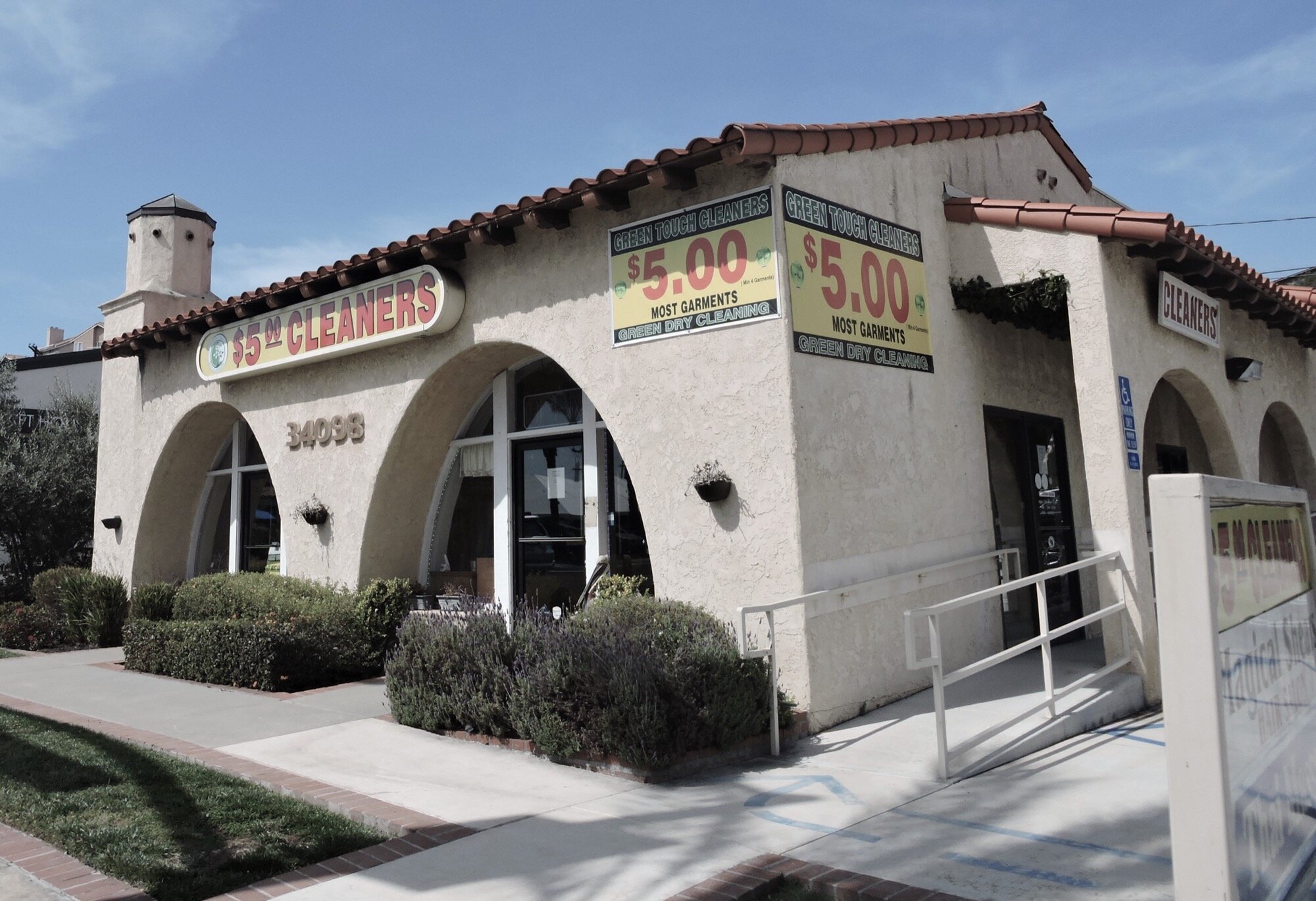
The Christiensen and Grow Filling Station (ca 1929) still stands on the old state highway, at 305 S Main Street in Orange, and is eligible for the National Register of Historic Places. Preserve Orange County is nominating it this spring.
Through the first 15 years of the 20th century, automobiles came onto the market but were unaffordable for most Americans. Early road trippers carried everything they needed with them as lodging and services were widely scattered and unpredictable. As automobiles became affordable to more Americans, greater numbers of travelers sparked an increase in establishments to serve them. By the late 1920s buildings for the express purpose of providing fuel, repairs, food, and lodging came on the scene, perhaps nowhere more so than Southern California. An exhibit at the Petersen Automotive Museum recreated a 1920s gas station to illustrate this period in our culture and history.
In his book on roadside vernacular architecture, Jim Heimann documents the broader pattern of Programmatic architecture beginning in the 1920s and reaching its high point between 1928 and 1934. One dimension of the revivalist movement in architecture was the evocation of “medieval imagery meant to be read through our remembrances of the fairy-tale world of Hansel and Gretel. These little witches’ cottages—which might serve as real estate offices, service stations, or fast food restaurants—play an intriguing game with scale and other make-believe elements.” He postulates that the world of fairy tales was reinforced by the dream world of the Hollywood motion picture. The studio offices for Irvin C. Willat Productions designed by Harry Oliver in 1921 marked the beginning of this trend in architectural design that continued into the 1930s. It seems Heimann speaks directly to the architecture of this gas station in Orange.
Driving around Orange County, one sees few historic gas stations extant. Even fewer date back to the 1920s.
Sources:
California Department of Transportation, “A Historical Context and Methodology for Evaluating Trails, Roads, and Highways in California,” https://dot.ca.gov/-/media/dot-media/programs/environmental-analysis/documents/ser/caltrans-highways-a11y.pdf, 2016.
Heimann, Jim. “California Crazy and Beyond: Roadside Vernacular Architecture,” Chronical Books, San Francisco, 2001.
Brigandi, Phil. “Three Road Trips,” County Courier, www.ochistoryland.com, April 2015.
Masters, Nathan. “How El Camino Real, California’s ‘Royal Road,’ Was Invented,” www.kcet.org, January 2013.
Faigin, Daniel P. “California Highways,” www.cahighways.org, 1996-2020.
David Rumsey Map Collection, David Rumsey Map Center, Stanford Libraries, Stanford University, CA, www.davidrumsey.com.
Aegis, “Historic Architectural Resources Inventory,” City of Dana Point, Historic Preservation Program, www.danapoint.org, 1997.
National Park Service, National Register of Historic Places, www.nps.gov/subjects/nationalregister/index.htm.
Historic Resources Group, “Historic Resources Survey Update,” City of San Clemente, www.san-clemente.org, 2006.
Blodgett, Peter J., “How Americans Fell in Love with Taking Road Trips,” Zocalo Public Square, www.time.com, 2015.